Geography & local history · Classroom resource
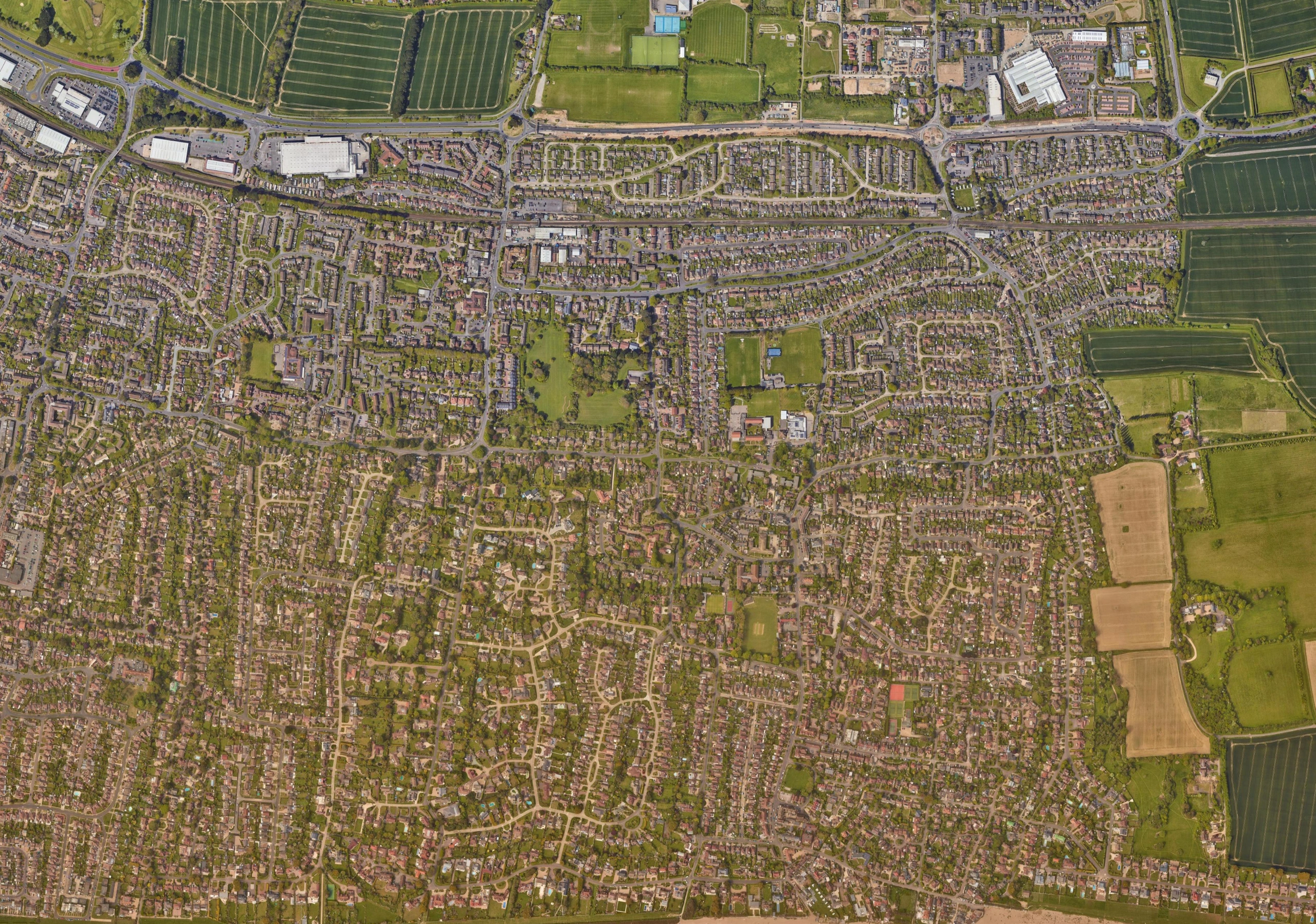
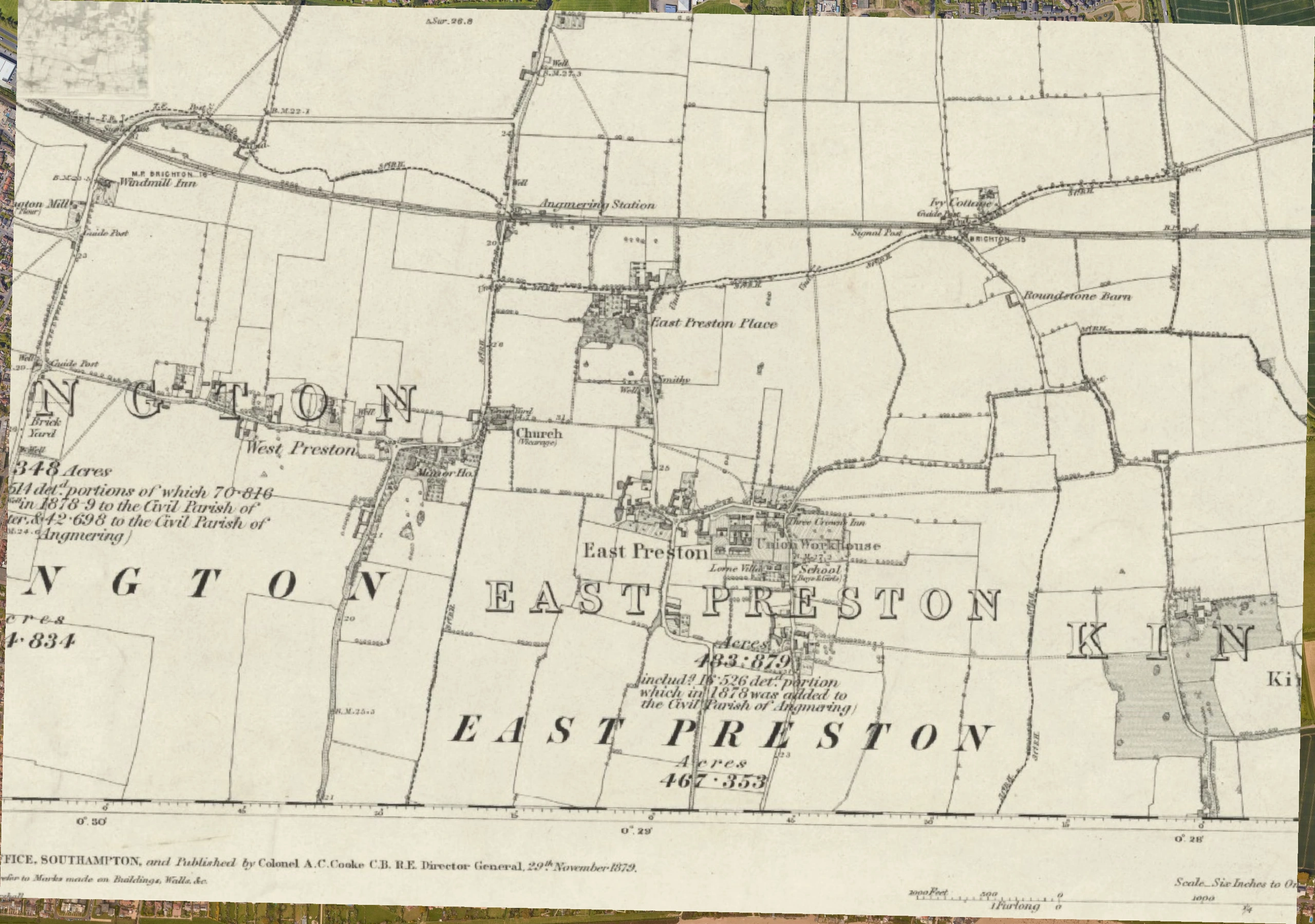
East Preston: 1886 and today.
Explore how East Preston has changed from fields and lanes to the settlement visible in modern satellite imagery.
Drag the dividing line, or use the slider below. With the slider selected, use the arrow keys to make smaller changes.
 1886Today
Today only1886 only
Using the comparison
Compare roads, field boundaries and buildings. The historical map and satellite image use different visual conventions; small alignment differences should not be treated as precise measurements.
Look closely
- Which roads or landmarks can you recognise in both views?
- Where has the settlement or landscape changed most?
- Which differences might come from the way the map or photograph was made?
Maps and credits
Historical map: Ordnance Survey, 1886, as identified in the original resource. Modern satellite imagery: Google satellite. The historical scan provider and the satellite imagery’s full provider credits have not been supplied.