Britain: 7000 BC and today.
Compare the coastline and explore the land now beneath the North Sea.
Drag the dividing line, or use the slider below. With the slider selected, use the arrow keys to make smaller changes.
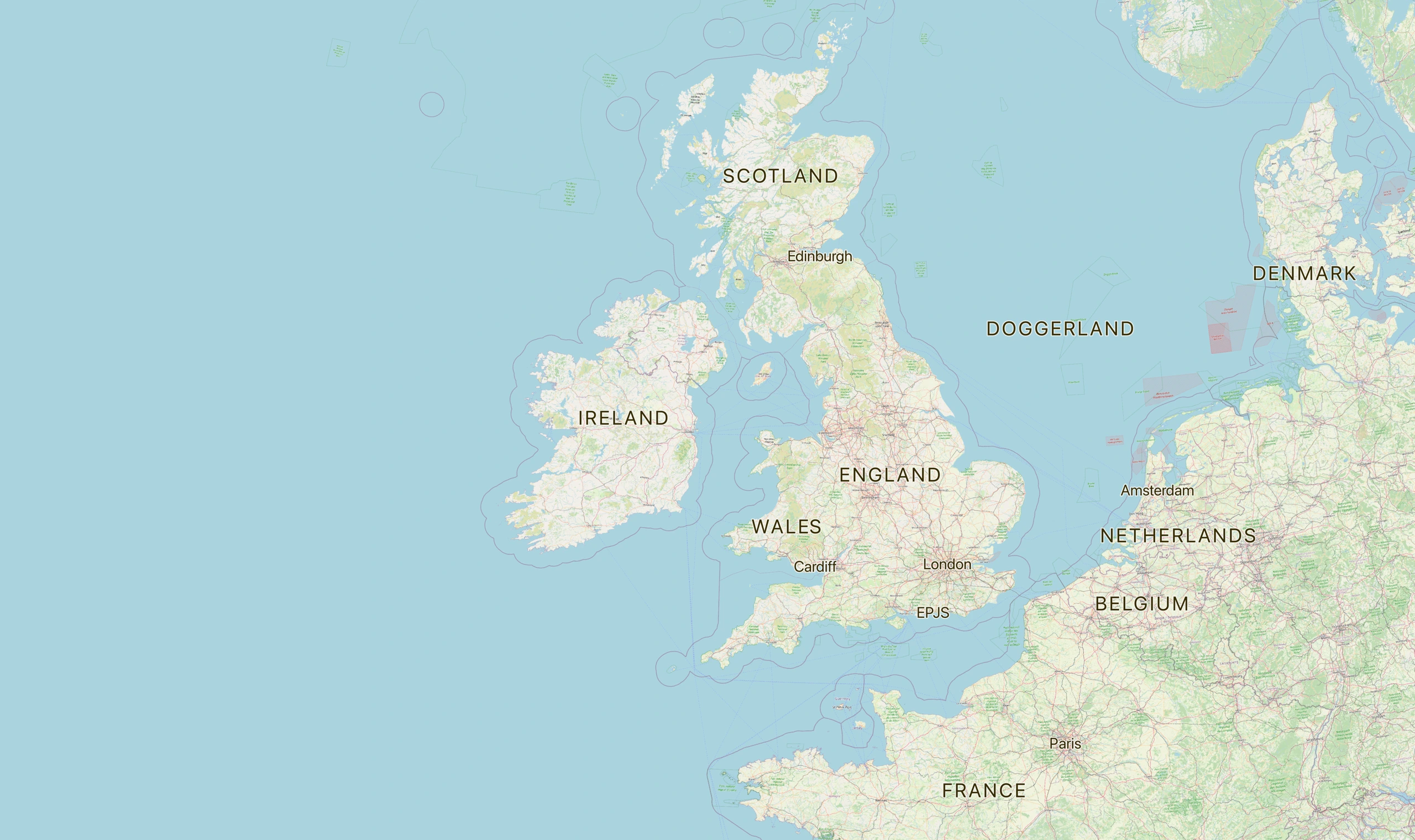
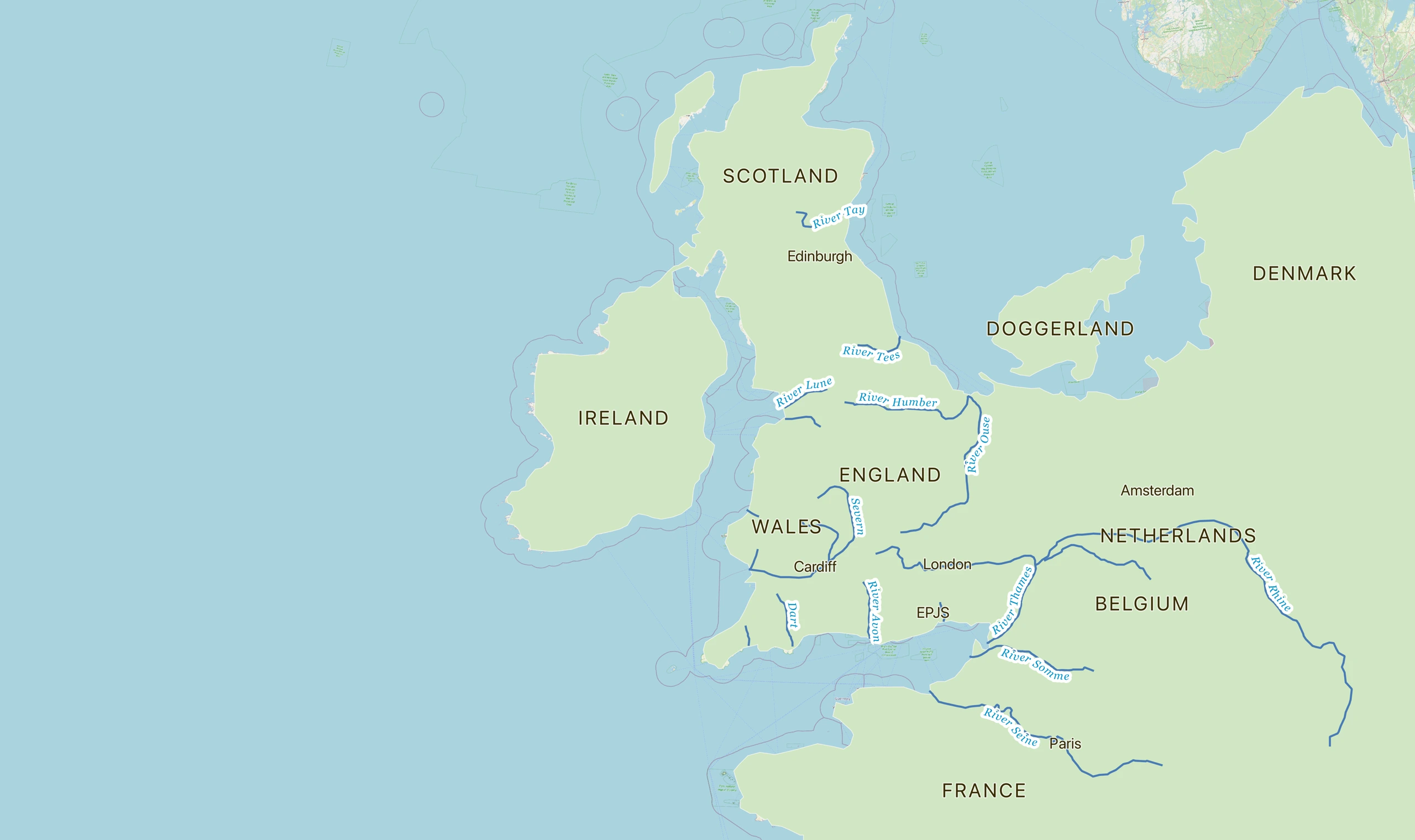 7000 BCToday
Look closely
- Which areas shown as land on the historical map are beneath the sea today?
- How might a changing coastline affect where people could live and travel?
- What can these maps tell us, and what would we need other evidence to find out?
Treat the historical coastline as a reconstruction, rather than an exact boundary. Modern place names are included to help locate familiar areas; they do not describe settlements in 7000 BC. The historical view is based on the 7000 BC coastline shown in the source illustration.
Maps and credits
Historical map adapted for this classroom resource from the Doggerland illustration credited to Europe’s Lost Frontiers Project in Smithsonian Magazine’s article, Study Rewrites History of Ancient Land Bridge Between Britain and Europe (Nora McGreevy, 2 December 2020). The source illustration includes a reconstructed coastline labelled 7000 BC. Basemap © OpenStreetMap contributors, available under the Open Database Licence (ODbL).